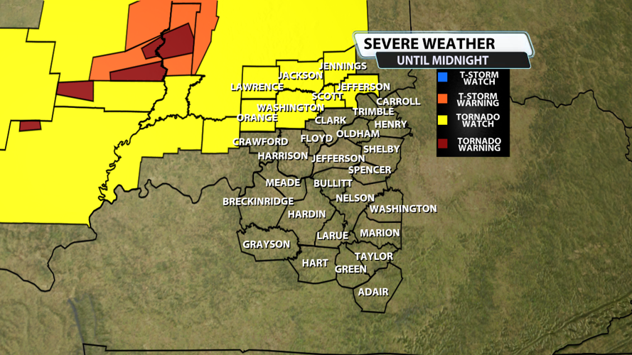

The NWS Storm Prediction Center has issued a
* Tornado Watch for portions of
Central and Southern Indiana
* Effective this Sunday afternoon from 545 PM until Midnight EDT.
* Primary threats include...
A couple intense tornadoes possible
Scattered damaging wind gusts to 70 mph possible
Isolated large hail events to 1 inch in diameter possible
SUMMARY...A cluster of severe thunderstorms with embedded supercells
will likely move east into the Watch area this evening. A couple of
supercells will pose a risk for tornadoes, including the possibility
of a strong tornado. In addition to the tornado threat, scattered
severe gusts 60 to 70 mph are possible.
The tornado watch area is approximately along and 45 statute miles
north and south of a line from 35 miles west of Bloomington IN to 60
miles southeast of Indianapolis IN. For a complete depiction of the
watch see the associated watch outline update (WOUS64 KWNS WOU5).


