


We've had fairly consistent rain this morning, but we'll see a transition to storms with heavy rain and a low-end severe weather threat this afternoon and evening. Let's talk about the setup for today.

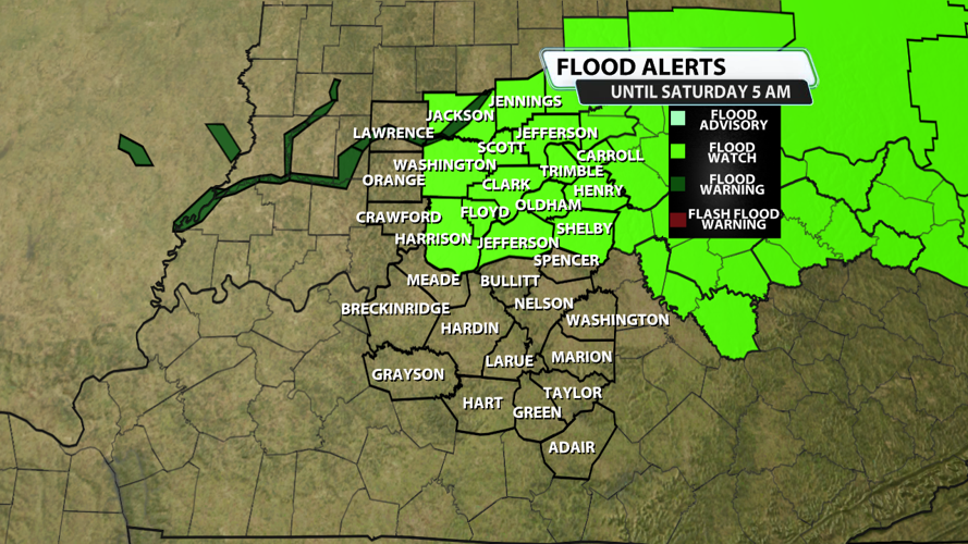
...FLOOD WATCH IN EFFECT THROUGH LATE TONIGHT...
* WHAT...Flash flooding caused by excessive rainfall continues to be
possible.
* WHERE...Portions of Indiana, including the following areas, Clark
IN, Floyd, Harrison IN, Scott IN and Washington IN and Kentucky,
including the following areas, Jefferson, Jessamine, Madison,
Oldham, Shelby and Woodford.
* WHEN...Through late tonight.
* IMPACTS...Excessive runoff may result in flooding of rivers,
creeks, streams, and other low-lying and flood-prone locations.
Creeks and streams may rise out of their banks. Flooding may occur
in poor drainage and urban areas.
* ADDITIONAL DETAILS...
- Incoming clusters of storms producing heavy downpours creates
the potential for flooding in isolated areas later this
evening.
- http://www.weather.gov/safety/flood
PRECAUTIONARY/PREPAREDNESS ACTIONS...
You should monitor later forecasts and be prepared to take action
should Flash Flood Warnings be issued.

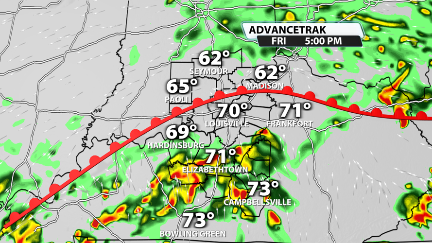
Showers are transitioning to storms this afternoon as the warm front moves north and takes over our Kentucky counties. Storms along and south of the front will have extra energy, higher dewpoints, and winds that are more conducive to creating severe weather than storms north of the warm front. Storms could drop a quick 0.5" to 1" of rain, so places that receive multiple storms could easily pick up 2" of rain or more over the next 12-16 hours.

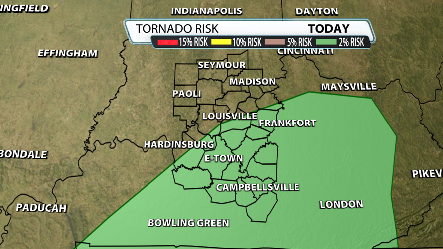
The SPC has outlined most of of Kentucky counties in a 2% risk for a tornado. The most likely timeframe is from now until 9 PM this evening. In these scenarios, tornadoes tend to be short-lived and weak; however, we have seen strong tornadoes along a warm front in our area including the Washington Co., KY, in April of last year. That tornado killed two people. Ever rotating storm is worth watching today, and our weather team is on it.


